Note: Sea levels are rising at a pace unparalleled in modern times and storms are becoming more intense as a result of global warming. This story is part of a weeklong series examining our rising oceans, the impact on our region and what government, scientists and others are doing to track change and mitigate damage.
Click here to read the series.
Bigger’s not always better.
That’s the way Danika van Proosdij, a geography professor at Saint Mary’s University in Halifax who teaches a course in Bay of Fundy environmental issues, views the province’s 240-kilometre network of dikes.
“In some areas, making a dike higher is just not feasible anymore,” said van Proosdij, team leader on a $1.8-million federal project to restore 75 hectares of marshes in the Bay of Fundy.
RELATED:
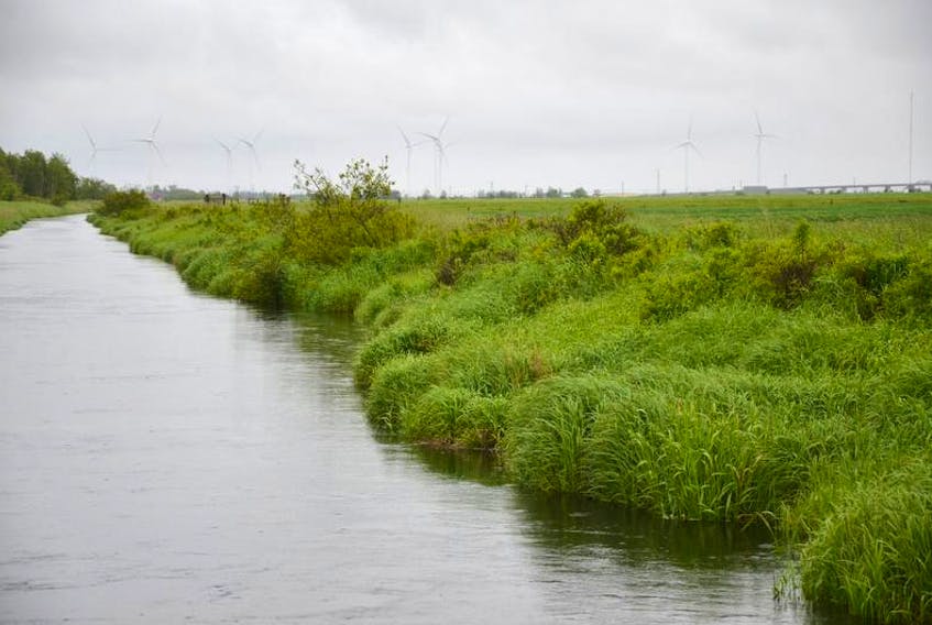
Van Proosdij said many of the earthen Acadian dikes constructed three centuries ago were built close to the rivers and followed the contours of the river itself.
“It is kind of like a windy snake,” she said. “What we are doing in some of the sites is actually straightening out that line. Instead of following every bend and turn in a river, we are actually selecting a line that is a little bit inland and that is actually a shorter distance and there is less dike to maintain.”
The four-year project will focus on four sites, including the Cornwallis River near Kentville and the Converse marsh in Cumberland County. The dike at the Cornwallis River site has already been breached.Two other sites identified as high risks were to be selected from a list of five locations.
“These are areas that have been identified by the Department of Agriculture as areas where the dike is at risk of failing,” van Proosdij said. “One of the ways you can respond to that is by actually moving where the orientation and line of that dike is and allowing part of that section that was formerly behind the dike to actually have tidal flow so you will get the reintroduction of saltmarsh species.
“That provides a natural buffer to coastal erosion and absorbs storm water energy and helps to protect the dike that remains and the land that remains and the new dike that you build further back. “
She said the project has no funding to purchase land and its limited budget will probably preclude sites that require extensive archeological work.
Van Proosdij said the project entails examining site preconditions, designing changes and monitoring the effects of those alterations.
“Think of them as demonstration pilot sites so that people can understand if it does work and what to expect,” she said. “So we can have a kind of a playbook, in a sense, that is tested so people can see in Cornwallis, in the river system, this is what happens, this is what it looks like, this is what we need to consider.”